For the next 6 years, Planetek Hellas will support the Rapid Mapping Component of the European COPERNICUS Emergency Mapping Service (CEMS). With more than 650 events, and over 5000 satellite maps delivered to more than 46 countries in ten years of activity, the service has been supporting the First Response Units around the globe when disasters occurred.

The service provides the European Commission with on-demand satellite maps of areas affected by natural disasters or humanitarian crises within just a few hours from request. Maps are all accessible free of charge by all civil protection, emergency and territory management users, facilitating damage assessment procedures, allowing relief agencies to respond much more quickly and efficiently.
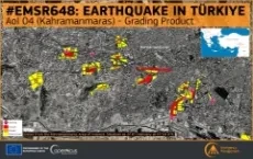
The Copernicus Emergency Management Service (CEMS) uses satellite imagery and other geospatial data to provide free of charge mapping service in cases of natural disasters, human-made emergency situations and humanitarian crises throughout the world. It covers in particular: Floods, Earthquakes, Landslides, Severe Storms, Fires, Technological disasters, Volcanic eruptions, Humanitarian crises, Tsunamis.
EMS – Rapid Mapping, which is active 24 hours a day 365 days a year, will be operated by a consortium led by e-GEOS and its German subsidiary GAF, Telespazio Iberica in Spain, the Italian company Ithaca, French partners Sertit and CLS, GMV in Portugal, IABG in Germany, Planetek Hellas in Greece and Hensoldt Analytics in Austria.
"Operating from Athens, Greece, and being part of a European consortium of top-notch companies that will provide Rapid Mapping products for the Copernicus Emergency Mapping Service, is an honour, a responsibility and at the same time a confirmation of the the related capacity built in Planetek Hellas" Stelios Bollanos, Director of Planetek Hellas, declared.
Download and read the Press Release
Similar projects
- ECFAS: European Coastal Flood Awareness System
- SAFER Services and Applications For Emergency Response
- SDI for Civil Protection in Calabria Region
- EO4SD Disaster Risk Reduction