
AIX is a satellite as-a-service platform providing on-demand, in-orbit data processing resources to turn raw data into actionable knowledge.

MARINE-EO Info Day Webinar - January 14th, 2021 (13:00 - 17:00 CET)

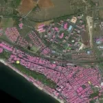
The European Environmental Agency (EEA) announces that new high-resolution Coastal Zones data reference years 2012 and 2018, and accompanying change mapping are now available.
 

Wildfires represent a significant threat to environmental resources, with hundreds of thousands of hectares of burnt areas and invaluable loss

Webinar: Earth Observation cloud services and OCRE funding opportunities for Research

Helping professional and amateur fishermen enhancing the fishing experience

Cognitive Framework of marine and coastal areas and public defense works

Geospatial Indexes for Territorial Planning and Strategic Environmental Assessment. Monitoring of soil loss.

Cognitive Framework for Urban Planning and monitoring of Strategic Environmental Assessment (SEA).

Subscribe to