Planetary Geoscience Information System

The growing European interest for the geosciences applied to the planetary exploration has found a notable involvement of the Italian and European Space Agency.
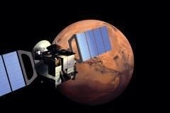
The Italian Space Agency has in fact a remarkable programme for the exploration of the Solar System, and ESA is fully involved in this venture.The European missions, with European and Italian participations, will provide a huge amount of geoscientific data.
In order to have full access to these data, the scientific community needs to have them partially interpreted. In North America, the Astrogeology Branch of the US Geological Survey, under NASA contract, is providing this opportunity coordinating the mapping activity, and providing data as hardcopy and/or on electronic support. In Europe there is not a similar institution. Moreover, the problem in our Continent is also more complex due to splitting and sharing of duties and commitments among several space agencies and institutes. PAGIS (Planetary Geosciences Information System) wants to demonstrate the possibility to set a similar system to provide coordinated data analysis and data dissemination.
In 2002 MEGIS (Mars Express Geosciences Information System) project has been financed by ASI in order to analyse the feasibility of the project integrating several data sets. MEGIS has proven the data fusion technique is a powerful tool in analyzing data from planetary missions and has demonstrated that the Geosciences Information System can be used for other planetary missions to different bodies of the Solar System.

PAGIS (Planetary Geosciences Information System) is the evolution of the precursor MEGIS and intends to provide a reliable tool to the scientific community to store and analyse data sets and geoscientific products in a Geographical Information System environment.
The project deals with set up of a GIS (Geographical Information System) for the data archive, handling, and analysis of the planetary missions. This project aims to reach two important goals:
- to implement a common system to store, retrieve and process satellite data acquired by different instruments in a user friendly way and in a Web standards format
- to realize the first European planetary data system integrating data from Mars Express and other future missions
The project will be realized by a consortium made up of IRSPS (International Research School of Planetary Sciences), CORISTA (Consortium for the Research on Advanced Remote Sensing Systems), SOGESI and Planetek Italia s.r.l.
 The general objective addressed by PAGIS is to reduce the historical gap of Italy and Europe from the USA, leaded by NASA and USGS, in the field of planetary data processing and analysis of geological data. So, the final goal backing the project is to create a network of institutions capable of analyse data, that, under the coordination of the IRSPS and ASI will provide the scientific GIS products to ASDC (ASI Science Data Centre) for distribution. -ESA website of Mars Express Mission