


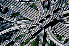
When an engineering company approaches the phases of planning and design of an on-shore or off-shore infrastructure, from railways to pipelines, from highways to dams, it must take care of the environment in which this infrastructure will serve, considering different points of view.
Indeed, it is important to evaluate the morphology of the area, the impact of the construction activities on the environmental dynamics, the possible future coexistence between works and neighboring areas.
The analysis of satellite remote sensed images proposes itself as a new frontier in the field of the support to design and environmental monitoring. Cooperating with other technologies, based on aerial/UAV/lidar surveys and measurement campaigns of environmental and cartographic features, satellites allow the improvement of the relationship between performances and costs, reducing the time needed to acquire the information.
Modern satellite sensors, capable to acquire Earth data quickly and worldwide, give the chance to obtain updated pictures of the environmental situation, with resolutions, accuracies and costs which can vary according to the project requirements.
Planetek is an expert partner in the supply, in addition to satellite images, of added value services and data, obtained by merging different sources through automatic and photo-interpretation processing techniques, useful for supporting engineering companies in their activities.
In the field of the on-shore design, Planetek can provide services like:
- 3D surfaces modelling and reconstruction (Digital Elevation Models);
- Production of land use / land coverage maps;
- Creation and updating of cartographic layers;
- Vegetation / imperviousness / urbanization / urban heat islands / soil sealing maps – indexes;
- Support for Business planning in the renewable energy sector.
In the field of the off-shore design, Planetek offers its long experience in monitoring marine and coastal ecosystems, thus supplying services of:
- Submerged vegetation mapping (taking into account the possible distribution of species like Posidonia Oceanica);
- Oil spill from natural and/or anthropic sources: detection and analysis;
- Chlorophyll / Total Suspended Mapping / Temperature / Water Turbidity Mapping;
- Seasonal lifecycle of microorganisms;
- Bathymetric analysis.
Download the article "Civil and Construction Workflows with EO data"