SW Remote sensing
SW Remote sensing
![](https://www.planetek.gr/sites/default/files/styles/sixty-sixty/public/planetek-kadmos-240.jpg?itok=tjzdtEnu)
Kadmos is a suite of services that enables the combined and synergistic use of data from various missions
![](https://www.planetek.gr/sites/default/files/styles/sixty-sixty/public/sat_index.jpg?itok=hgSJUHt_)
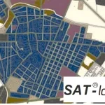
Geospatial Indexes for Territorial Planning and Strategic Environmental Assessment. Monitoring of soil loss.
![](https://www.planetek.gr/sites/default/files/styles/sixty-sixty/public/sat_land.jpg?itok=DAGJsFov)
Cognitive Framework for Urban Planning and monitoring of Strategic Environmental Assessment (SEA).
![](https://www.planetek.gr/sites/default/files/styles/sixty-sixty/public/sat_3d.jpg?itok=qQMnTxFX)
Digital Elevation Models derived from Satellite for orographic studies and for the design and management of works and infrastructures