In 1994 four young entrepreneurs founded Planetek Italia and based their activities in the technological Park of Tecnopolis in Valenzano, Bari (Italy).
Planetek Italia S.r.l. is a leading multidisciplinary Geographical Information Services (GIS) and Earth Observation consultancy company, which focus’s on information land management.
A challenging activity that Planetek Italia started and developed, starting from the technological Park of Tecnopolis in Valenzano, Bari (Italy), thanks to the business venture of its four founders Giovanni Sylos Labini, Mariella Pappalepore, Sergio Samarelli and Vincenzo Barbieri.
The History
Planetek Italia was founded in 1994 when four young entrepreneurs started its business venture and based their activities in the technological Park of Tecnopolis in Valenzano, Bari (Italy). Giovanni Sylos Labini, Mariella Pappalepore, Sergio Samarelli and Vincenzo Barbieri had the idea of starting providing products and services for geomatic and space sector, and still this is the goal of the company.
The technological Park of Tecnopolis was a good place to start, as the Park was organized to give support to start-up companies and to let Planetek cooperate with professionals working in the GIS and Remote Sensing Lab of the Park.
Timeline (watch here the full screen graphic timeline):
- After a few months the first reselling contract was signed to distribute the ER Mapper softwares in Italy. This helped the company to become one of the market leaders in the national market of Earth Observation solutions.
- At the end of 1994 the company is an Italian ESRI Business Partner for ArcInfo.
- Through the years the company grew up thanks to some important job orders.
- In 1996 started cooperation with ESA, the European Space Agency.
- In 1998 a research program made possible the development of solutions based on the integration of GPS data for the Public Transportation monitoring.
- In 1998 the company was certified ISO 9001 and then step-up to vision 2000.
- In 1999 became a member of AIT, the Italian Remote Sensing Association, in which Mariella Pappalepore had a role in the steering committee.
- The company still grew-up and this meant there were the first problems of working space. This lead the company find another headquarter. In 1999 was bought a 1.000 sqm. building that is the current headquarter.
- In 1999 was launched Ikonos, the first very high resolution satellite, and was signed the agreement for the data distribution in Italy between Planetek Italia and European Space Imaging.
- In 1999 the company gave a strong support to the start up of AIPAS, the Italian SMEs Aerospace Association, and Giovanni Sylos Labini became its Chairman.
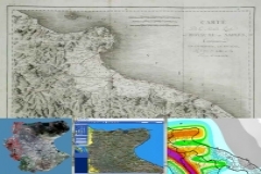
- In 2000 the first WebGIS development started and became a real WebGIS portal in 2001 with Atlante Italiano the webportal of the Italian Ministry of the Environment, based on the ER Mappers’ ECW compression format. In 2002 was launched also the Planetek’s web application Cart@net.
- In 2001 the first project involving the SAR data processing for ERS sensor and in 2004 had the important role of leading the main program in the field of landslide large scale monitoring funded by ESA and based on interferometry.
- In 2002 was published on the company website the free on-line course of Remote Sensing, a reference point for thousands of users.
- From 2003 Planetek Italia is a member of Confindustria.
- In 2005 Planetek was the promoter and founder of two spin-off companies. GEO-K, a spin-off company of Tor Vergata University, which is involved in radar data processing. And in 2006 GAP, a spin-off company of Politecnico di Bari which focuses techniques applied to Radar data Persistent Scatterer.
- In 2005 based in Athens, Greece, was founded Planetek Hellas.
- In 2006 the company became a member of Costellazione Apulia and shared with other 60 Apulian companies the mission of organizing itself as a sustainable company. The first step towards sustainability was to adopt in 2008 an environmnet managemnt system compliant to the UNI EN ISO 14001:2004 and a higher involvement in 2009 with the Directive CE n.761/2001 (EMAS).
- This committment has grown in 2009. The company has decided to be get the SA8000 certification, entering the “club” of the companies compliant to CSR (Corporate Social Responsibility).
- In 2008 Planetek Italia takes new challeges as a reseller in Italy of ERDAS solutions and of Digital Globe’s satellite WorldView-2 and Infoterra’s satellite TerraSAR-X.
- In 2009 Planetek Italia is one of the founders of Apulian Aerospace District.
- In 2010 is a member of OGC, the Open Geospatial Consortium, with the goal of promoting the culture of data sharing.
- In 2011 Mariella Pappalepore has been elected Chair of ICT Directorate of Confindustria Bari-BAT
- In 2011 Planetek has been awarded the development of the European INSPIRE Geoportal, the central portal for environmental information in the European Union and the discovery and view of EU member states enviromental data.
- In 2012 the Planetek2020 strategy starts. Four Strategic Business Units was born: Space Systems, European Institutions, Government & Security, Business 2 Business.
- In 2012 we are authorized distributors for the Italian territory of the integrated Intergraph Geospatial Portfolio (suite ERDAS and GeoMedia).
- In 2012 Planetek internationalization strategy becomes concrete in Europe and North Africa. The Company was awarded two important contracts for the Spatial Data Infrastructure of Ministry of Agriculture and Maritime Fisheries, and for the soil sealing monitoring and mapping in Europe for the E.E.A. (GMES Initial Operations HR Landcover).
- In 2013 we joined the Solar Wind Analyser investigation team for the European Space Agency's Solar Orbiter mission (ESA Cosmic Vision 2015-2025 Programme).
- In 2014 we celebrate 20 years of activity! (photo 1 - photo 2)
- In 2014 we have changed our logo. Read the article here (pdf)
Watch here the full screen graphic timeline
Leave us your comment on facebook or twitter